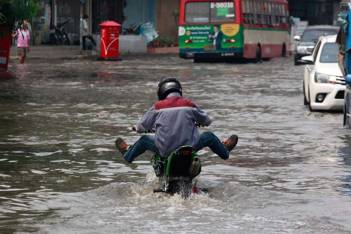
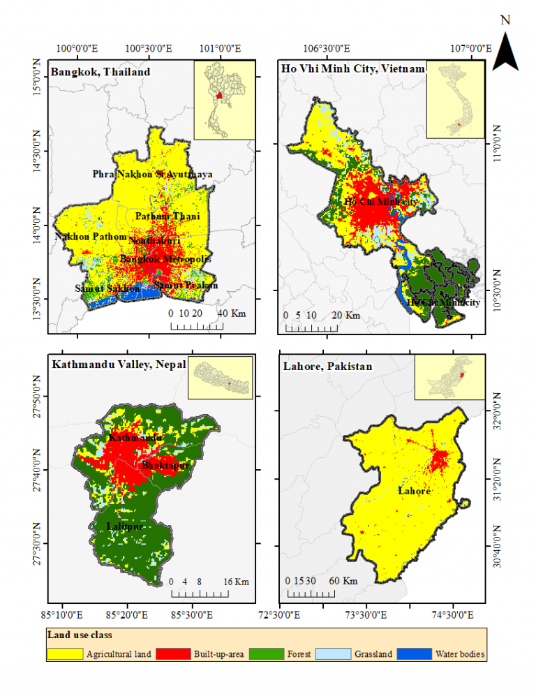

Ho Chi Minh City (HCMC), Vietnam has undergone tremendous transformation in land-use practices in the past few decades. The groundwater-related issues have also been a major concern in the fast-growing southern city of Vietnam. Quantitative prediction of the impact on groundwater recharge due to changes in the land-use pattern of a watershed is crucial in developing sound groundwater management schemes. This study aims to evaluate the impacts of change in land-use patterns on the quantity of groundwater recharge in HCMC. An empirical land-use projection model (Conversion of Land-use and its Effects, Dyna-CLUE) and a hydrological model (Soil and Water Assessment Tool, SWAT) was used for the study. Three future land-use scenarios of Low Urbanization Scenario (LU), Medium Urbanization Scenario (MU) and High Urbanization Scenario (HU) were developed in Dyna-CLUE focusing on the increase of built-up area to generate land use maps of HCMC until the year 2100. The land-use maps for all three scenarios were then used in the calibrated hydrological model SWAT to get the future recharge in the near future (2016–2045), mid future (2046–2075) and far future (2076–2100). The recharge was observed to increase in the far future of LU by 10% while reduction of 30% and 52%
Assessment of Deep Groundwater Quality in Kathmandu Valley Using Multivariate Statistical Techniques
Ho Chi Minh City (HCMC), Vietnam has undergone tremendous transformation in land-use practices in the past few decades. The groundwater-related issues have also been a major concern in the fast-growing southern city of Vietnam. Quantitative prediction of the impact on groundwater recharge due to changes in the land-use pattern of a watershed is crucial in developing sound groundwater management schemes. This study aims to evaluate the impacts of change in land-use patterns on the quantity of groundwater recharge in HCMC. An empirical land-use projection model (Conversion of Land-use and its Effects, Dyna-CLUE) and a hydrological model (Soil and Water Assessment Tool, SWAT) was used for the study. Three future land-use scenarios of Low Urbanization Scenario (LU), Medium Urbanization Scenario (MU) and High Urbanization Scenario (HU) were developed in Dyna-CLUE focusing on the increase of built-up area to generate land use maps of HCMC until the year 2100. The land-use maps for all three scenarios were then used in the calibrated hydrological model SWAT to get the future recharge in the near future (2016–2045), mid future (2046–2075) and far future (2076–2100). The recharge was observed to increase in the far future of LU by 10% while reduction of 30% and 52%
The objective of this paper is to identify the source and transport of nitrate in the groundwater aquifers of alluvial fans by stable isotopic techniques. Water samples collected from the precipitation, groundwater, and river water at the western Kofu basin were analyzed for the major cations, anions, and isotopes (δ18O and δ15N). Through the cluster analysis of the cations and anions, two groundwater aquifers formed on the Midai and Kamanashi alluvial fans were identified in the basin. Higher nitrate concentrations were observed in the groundwater aquifers of the Midai alluvial fan, and the values of δ15N suggest that the major sources of nitrate are the inorganic and organic fertilizers applied in the orchards and paddy fields. The values of δ18O show that precipitation and river water are sources of recharge in both the aquifers. A strong positive correlation between the nitrate concentration and the δ18O values of both the groundwater aquifers shows that precipitation water acts as a carrier and river water facilitates dilution in the nitrate loading from terrestrial catchments.